
J10 Laser RTK: Next Level Multi-Technology GNSS Receiver with Laser for Challenging Surveying Tasks
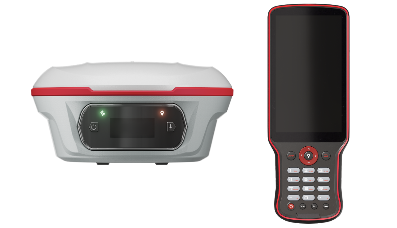
The J10 is a premium GNSS receiver that combines state-of-the-art GNSS, IMU, laser, and dual-camera technologies into one device. Leveraging the sophisticated laser capabilities developed in the Universe Series, the J10 also integrates SinoGNSS’s newest visual stake-out features. This powerful fusion enables immersive and efficient surveying and stakeout, even in environments that are typically difficult to access, suffer from signal blockage, or pose safety risks
---
Laser Technology
The J10 Laser RTK features a green laser that reaches up to 50 meters with excellent visibility even in daylight. This ensures precise measurements in difficult-to-access areas, signal-obstructed zones, or hazardous sites where using a range pole is impractical.
Visual Stakeout
Equipped with a camera, the J10 provides surveyors with a 3D visual interface through the Survey Master software. Operators simply follow the directional arrow and monitor real-time distances while the stakeout points are clearly marked on the ground, enabling even novices to complete stakeouts efficiently without repeatedly moving the pole.
Advanced Datalink
Compatibility of the J10 has been significantly improved. Its sophisticated datalink supports seamless operation with ComNavTech GNSS receivers as well as other major brands, handling multiple protocols including Transparent, TT450S, South, and SNLonglink. Under optimal conditions, SNLonglink enables a working range of up to 15 kilometers.
Auto-IMU Functionality
The J10 comes with Auto-IMU technology, removing the need for manual calibration by automatically initializing and calibrating the system. It supports tilt compensation up to 120° across conventional, laser, and visual modes, simplifying fieldwork.
Full Constellation & Multi-Frequency Support
Boasting 1688 channels and tracking over 60 satellites, the J10 achieves fast fixed solutions within seconds, greatly enhancing efficiency. Additionally, it supports PPP functions such as HAS and B2B for precise positioning.
OLED Color Display
The J10’s OLED color screen provides clear visual feedback on satellite count, fix status, power state, and other key parameters, offering surveyors intuitive control over the device during operation.